
Search Schenectady Streets by Address
For a Schenectady street directory search, begin with a complete street number and name. First locate the parcel, then compare the assessment entry with the map key, and only then open the land-record index. That order keeps the address, current tax owner, and recorded transfer history from being blended into one claim. The City assessment roll is a dated tax snapshot, while a recorded deed is evidence of a transfer. Neither source, by itself, establishes every person who lives at the address.
- Search the address in the county-linked Beacon property route and note the situs location, owner, mailing address, parcel or print key, values, exemptions, tax district, and update date.
- Open the City GIS parcel layer, confirm the parcel geometry, and retain the print key, SWIS/SBL, or section field that bridges the map to the property record.
- Search the owner in the County Clerk index as a grantee, capture the deed reference and legal description, then work backward through earlier grantors where the record supports it.
- For a civic-record check, use the state voter match form for a known person. It is not a public street-browse tool.
- When the question concerns an earlier address, compare the street section of a historical directory or criss-cross volume with maps and parcel geometry for the same period.
Use one notebook line for each source date. That simple practice helps distinguish a present assessment field from a historical directory entry or a deed recorded years earlier.
Schenectady Street Parcel Keys
Street text is useful, but it can change across records. In Schenectady, the City GIS layer exposes parcel geometry with fields including SWIS, print key, SECNO, and SWIS/SBL. Those keys are the bridge when an older document uses a legal description or when a street number appears differently in a directory. The map layer does not expose owner, mailing-address, assessed-value, exemption, or sketch fields, so those details must be checked in Beacon or the assessment record rather than inferred from the polygon.
The City’s hosted parcel layer shows the kinds of identifiers available for this handoff.
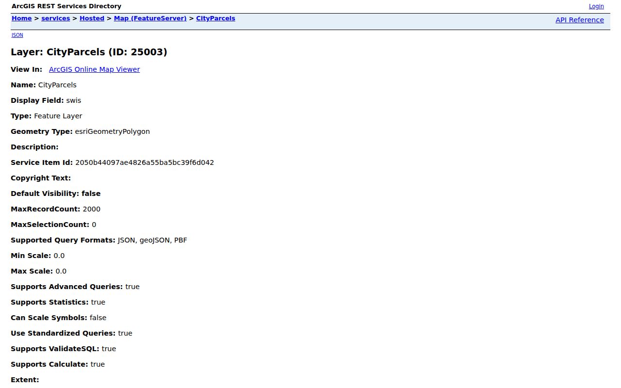
Copying the parcel key before moving to an assessment or deed search preserves the link between a Schenectady street address and the mapped piece of land.
- Parcel
- A mapped unit of land used in the assessment and tax system.
- Situs address
- The physical location of the parcel, distinct from an owner’s correspondence address.
- Recorded plat
- A filed map that can show lot, block, subdivision, or other legal-description relationships.
- Criss-cross directory
- An address-first directory used to connect a printed address with a listing from its publication year.
Note: Save both the printed address and the parcel key because each can solve a different mismatch in Schenectady records.
Map Schenectady Street Geography
The CityData service supplies roads, neighborhoods, boundary context, parcels, parks, and streams. Its composite geocoder accepts a single-line address as well as separate address, city, neighborhood, Postal, and PostalExt inputs. A map result can be narrowed by geometry, distance, output fields, and returned geometry. The hosted layer advertises spatial queries, ordering, pagination, and distance queries, which makes it useful for following parcels along a block without treating the map as a list of people.
The City’s ArcGIS CityData service is the best starting point for the street-and-parcel context.
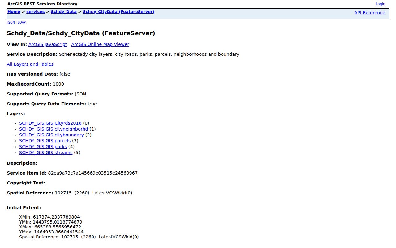
For an address-map question, use the map to verify where the street and adjoining parcels sit, then use the parcel identifier to reach records that carry names or transfer information.
This is a local geography check as well as a search step. Schenectady’s neighborhood profiles include Hamilton Hill/Vale, Mont Pleasant, Woodlawn, Union Street, Northside/Goose Hill, Bellevue, Central State, Downtown, Eastern Avenue, and the Stockade. A neighborhood label adds context, but it does not replace the parcel boundary or municipal record.
Schenectady Street Property Fields
The county points property searchers to Beacon, and the City Assessment pages provide annual-roll information. The live Beacon screen is dynamic, so its exact current field labels and order were not captured in the research. The documented search routes still show what to preserve when a result opens. Use the current City roll as a dated baseline, not as a full account of everyone connected with the address.
| Search field or result | Use in a street search | Research boundary |
|---|---|---|
| Municipality | Separates the City of Schenectady from other county municipalities. | Exact live options were not captured. |
| Owner name | Provides the person or organization indexed on the assessment record. | Matching and wildcard rules were not located. |
| Property address or street | Finds the situs-location route for the parcel. | Browse behavior and minimum characters were not located. |
| Parcel, SBL, or print key | Connects assessment data to GIS and legal-description research. | Exact live format was not captured. |
| ZIP field | May narrow a property search when the interface offers it. | Confirm the live label before relying on it. |
Beacon’s owner and mailing fields answer tax-record questions. The mailing field may be an estate, trust, organization, or correspondence destination. It must not be treated as proof that the owner lives at the situs address.
Schenectady Street Deed Chains
Once the parcel is stable, the County Clerk’s SearchIQS index supplies the recorded-instrument trail. Search the current assessment owner as a grantee near the acquisition period. A result can show party names, document type, recording date, a document or book-page equivalent, image access, and an unverified status marker. Record the grantor, grantee, document reference, date, and legal description before searching the seller as an earlier grantee.
SearchIQS documents a Party 1/Party 2 default, optional date range, and an asterisk wildcard. Its guide says an image asterisk can indicate an image is available; document view can also carry an “UNVERIFIED Document” label, with a red date in results. The index search is free, while images or copies can carry county fees. A free index hit is not a certified title determination.
Older instruments remain a necessary part of the street directory process because the County Clerk does not publish an online starting year. Use deed books, microfilm references, or the clerk counter when an online search ends too soon. The Clerk’s land-record information is available through the County Clerk land-records office.
Note: Search a legal description or alternate party name when the current street number does not return the expected instrument.
Schenectady Street Permits and Code
Address records also appear outside the property roll. The City building-permit form uses owner, contractor, designer, address, ZIP, telephone, email, work description, cost, and work-stage fields. A permit can date construction or alteration activity, but a named contractor or designer is not an occupant record. City code complaints likewise use an address or block context, and the City says a complainant’s name and address are encouraged rather than required.
The City’s neighborhood condition reviews are block-by-block observations involving Police, Fire, Property Maintenance, and Building. A public permit or case-search cutoff was not located. For an older, address-specific city record, identify the address, date range, and record type in an electronic FOIL request or ask the custodian about the counter route.
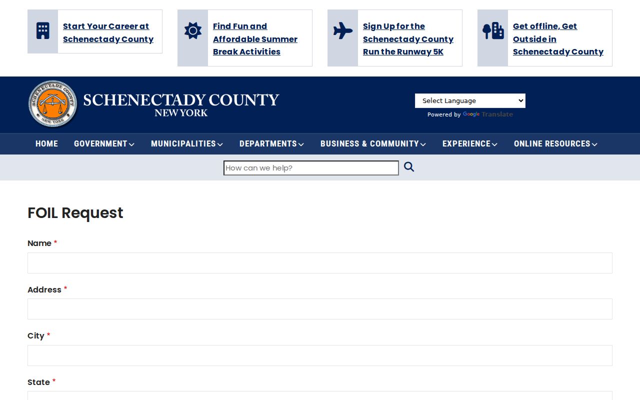
The request form is a fallback for agency records not otherwise available, while ordinary land-record copies and certifications remain County Clerk services.
Schenectady Street Records Compared
A Schenectady street directory becomes more useful when every record is read for its own purpose. Assessment records follow a tax parcel; GIS follows mapped geometry; deeds follow parties and a legal description; directories follow their printed listing date. The table keeps those different forms of evidence in view.
| Address-keyed source | Custodian | Street-level clue | Access route |
|---|---|---|---|
| Assessment roll and parcel card | City Assessor and Beacon | Owner, situs, mailing address, value, exemptions, and parcel key. | Public roll and county-linked portal. |
| GIS parcel layer | City ArcGIS and SIMS | Parcel geometry, roads, neighborhood context, SWIS, print key, and SBL fields. | Public map or REST query. |
| Deed, mortgage, or lien index | Schenectady County Clerk | Parties, instrument date, legal description, and document reference. | Free SearchIQS index; counter and copies for more. |
| Voter record or annual list | Board of Elections | Limited civic-registration information under the applicable rules. | Match form or supervised list access. |
| Permit or code record | City Building and Code | Work, address, and date clues. | Form, office, or FOIL route. |
| Historical directory | SCPL and local collections | Printed address, occupation, office, residence, or boarding clue for its year. | Library, archive, and digitized collection routes. |
For a modern parcel chain, move from the map key to the assessment entry and then to the recorded instrument. For a historical address question, pair a directory or newspaper finding with the printed street form and a map from the same era. The street name alone is often the weakest link.
Schenectady Street Voter Access
New York’s public voter match page asks for county, last name, first name, date of birth, and ZIP, with cookies and JavaScript required. It does not provide a browse-this-street screen. Use it only to check a known individual in the form’s matching process, not to make a street-wide list. The current static capture did not establish the live required markers or result fields, so those details should be confirmed in the live interface.
Election Law §5-602 provides for annual district lists with names and residence addresses in street-number or alphabetical order under Board of Elections supervision. A voter-registration data request has an elections-purpose certification requirement under Election Law §3-103(5). The Schenectady County Board of Elections is the local route for current format, fee, and eligibility questions; protected records and identifying numbers are withheld. The official New York voter registration search remains a match tool rather than a street directory.
Schenectady Street History Bridges
No verified citywide street-renumbering or formal readdressing project with a year was located in the reviewed official sources. That gap matters. Do not assume an old street number was changed on a known date, and do not treat an absent search result as proof that an address disappeared. Match an uncertain address through the legal description, map or atlas lot geometry, adjacent names, a directory street section, and the current GIS parcel key.
The local house-history sources include an 1850 city map, an 1856 county ownership map, an 1866 county atlas, city atlases from 1880, 1892, and 1905, and Sanborn editions from 1884 through 1961. Historical city directories begin with 1841–42 and have a long run through 1968 with documented gaps; criss-cross directories begin in 1967 and continue from 1971 in the listed holdings. The historical volumes are treated in greater detail in the Schenectady Directory Book.
Note: Preserve the publication year beside every historical address because a printed directory reflects only that volume’s moment in time.
Schenectady Street Counter Access
Online access is not the only route. The County Clerk’s Office is at 620 State Street, third floor, Schenectady, NY 12305, with regular hours of 8:30 to 4:30 and July and August hours of 9 to 4. Its counter handles older instruments, copies, certifications, document searches, and indexing questions. The research records a self-service copy fee of $0.50 per page, staff copies at $1 per page, a certification minimum of $5, and a document-search fee of $5. Confirm current charges before ordering.
For historical street evidence, Schenectady County Public Library holds census microfilm, newspapers, city and county directories, atlases, yearbooks, and genealogical indexes. The Schenectady County Historical Society’s Grems-Doolittle Library has deeds, maps, directories, wills on microfilm, newspapers, and finding aids, but visits require an appointment at least two business days ahead. These library and appointment routes are especially important where the online deed start year is not published.
Schenectady Street Directory Limits
A parcel map shows land, not a complete household. An assessment owner may receive correspondence elsewhere, a directory listing may describe an office or boarding place, and a permit applicant may be connected to work rather than residence. Utility-customer and delivery information are not public resident indexes, and DMV personal information is restricted by the federal DPPA. Protected voter records also cannot be bypassed through a public lookup.
New York’s Address Confidentiality Program uses substitute mailing addresses for qualifying participants, including confidential voter-registration coordination. Court and agency records can also be sealed or restricted. When a field is missing, ask the custodian whether access is limited rather than trying to reconstruct protected information from other sources.
Lawful use. Use Schenectady street records for a narrow, lawful purpose. New York stalking and harassment laws prohibit using address information to follow, threaten, or harm another person.